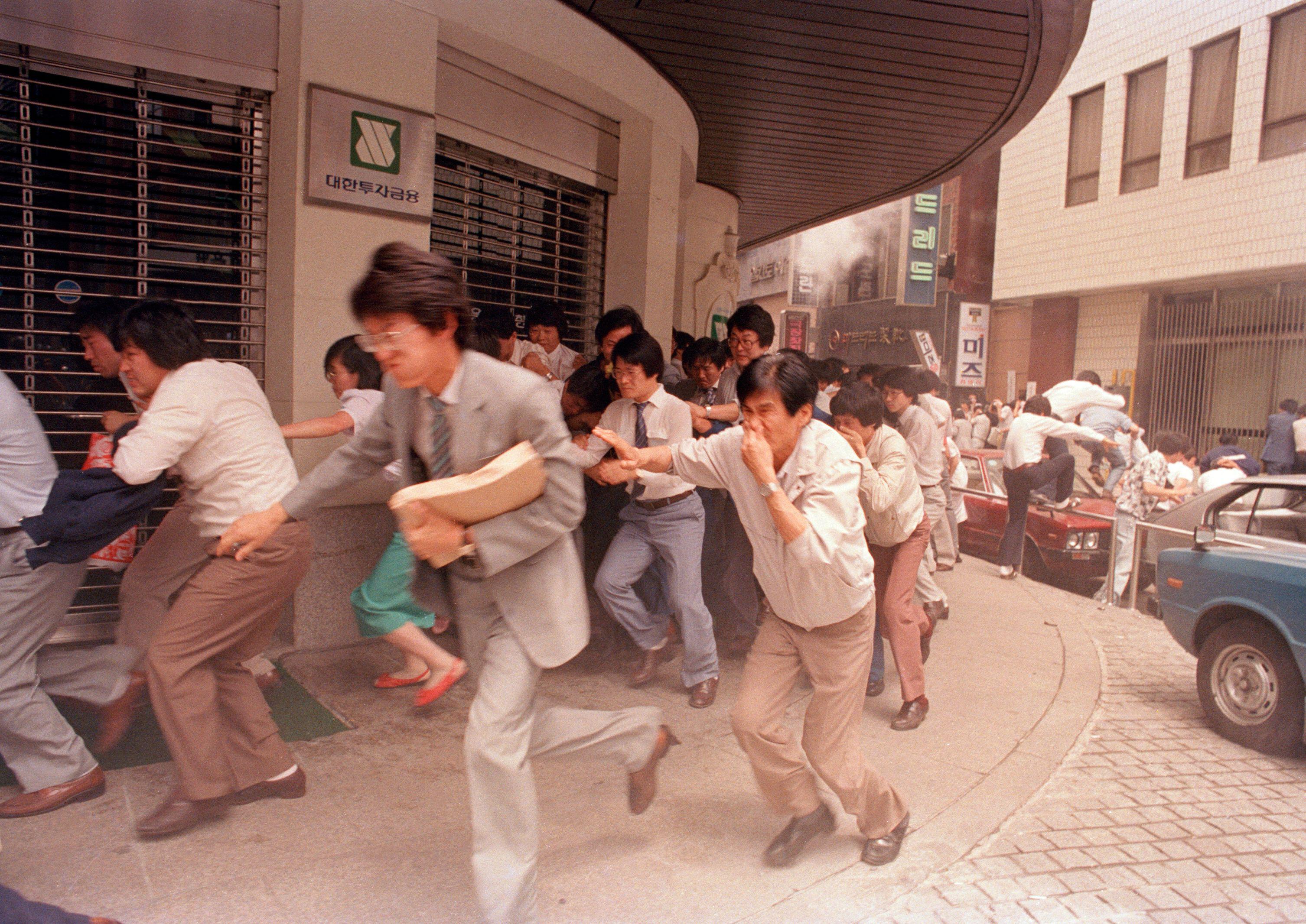
DescriptionProtesters fleeing after riot police hurled tear gas to break up a march in central Seoul during the nationwide June Democratic Struggle, as demonstrators attempted to march toward Myeongdong Cathedral to support students staging a pro-democracy sit-in.
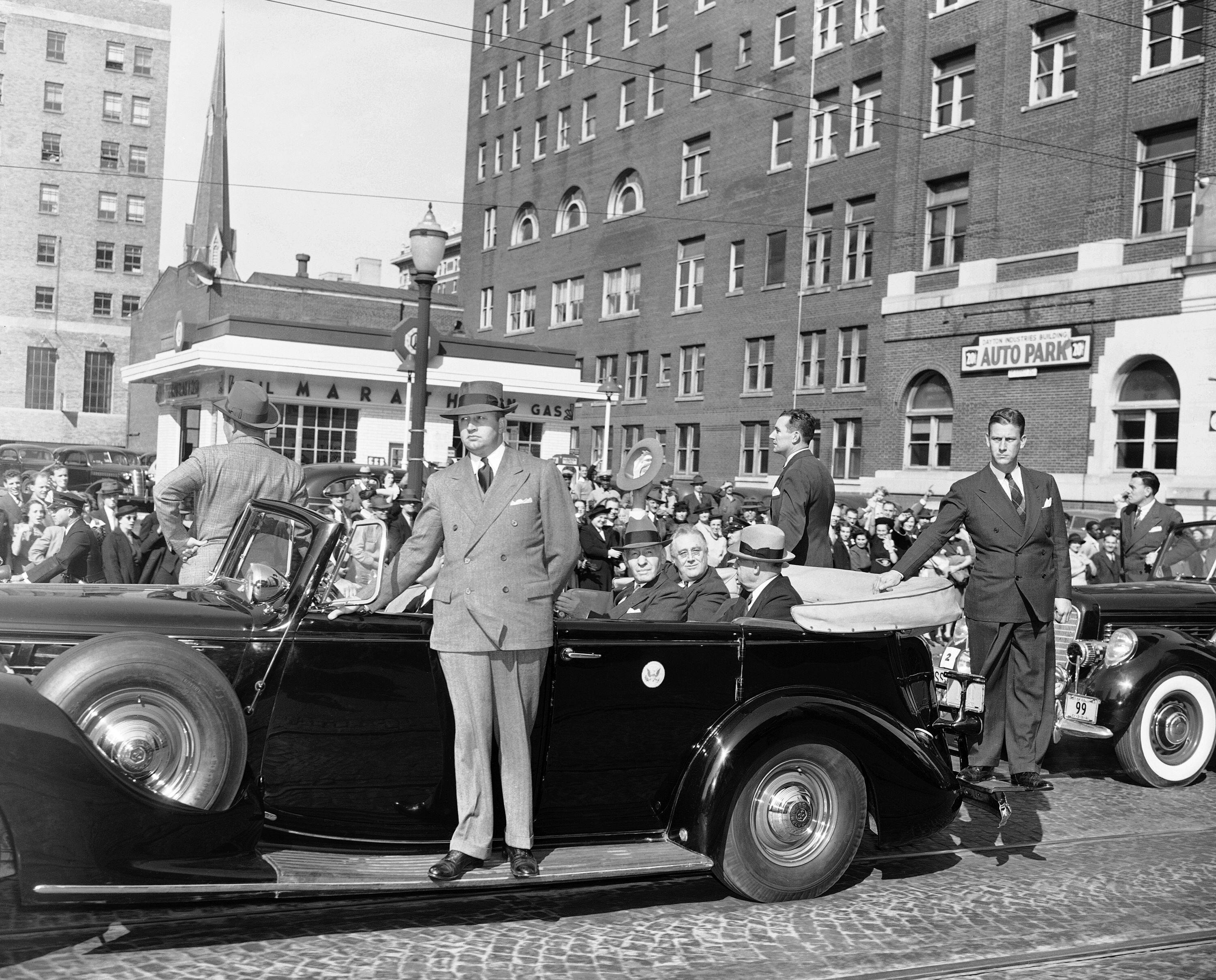
DescriptionPresident Franklin D. Roosevelt's motorcade proceeds through downtown Dayton, Ohio, during his visit to inspect the expanding Wright Field military air base amid the United States' military buildup as WWII raged in Europe. While the U.S. remained officially neutral until the attack on Pearl Harbor, Roosevelt viewed Nazi Germany as a growing threat and advocated expanding the nation's military preparedness.
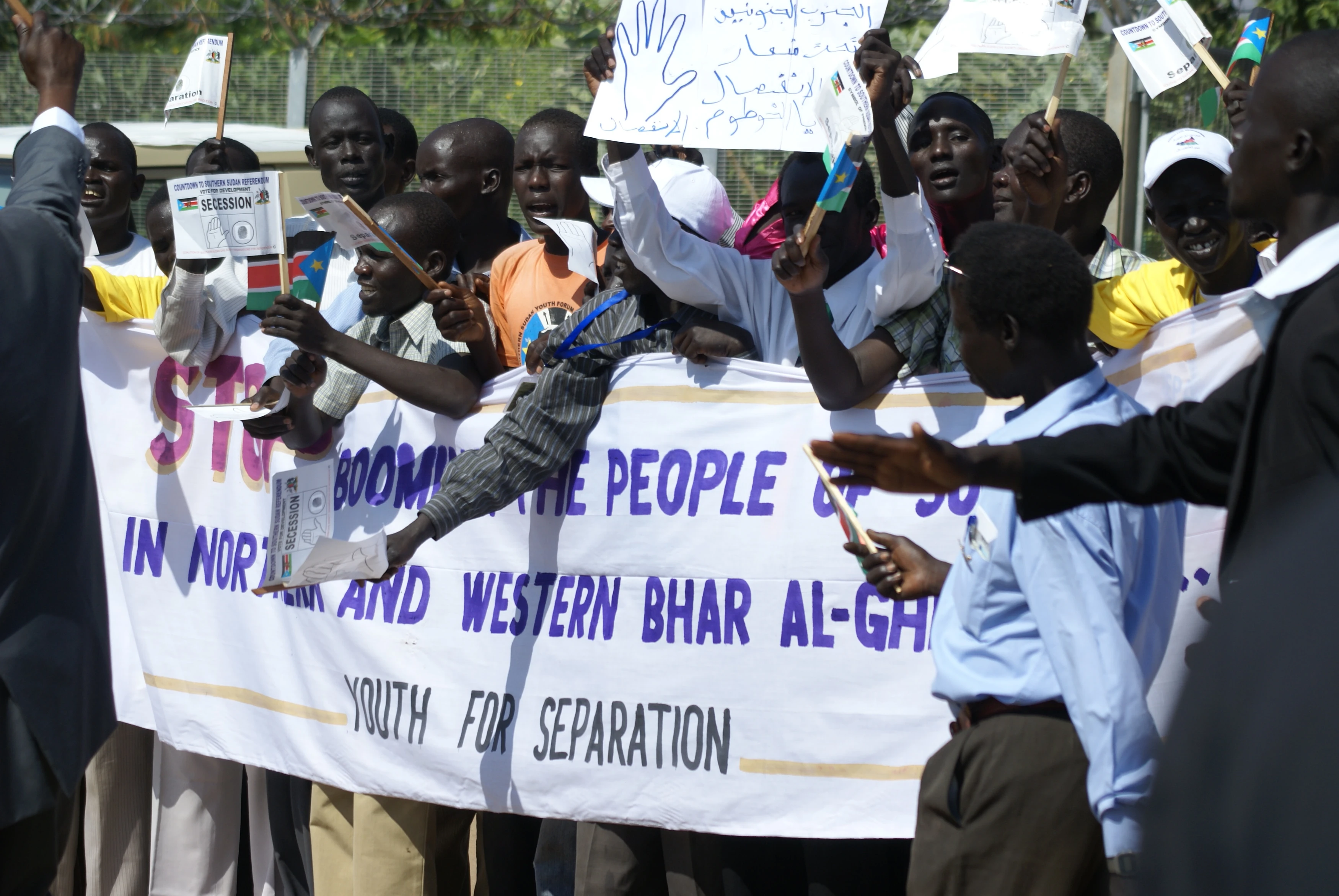
DescriptionA group of pro-independence Southern Sudanese activists rallying for independence in Juba Airport ahead of Sudanese President Omar al-Bashir's arrival. This gathering occurred just days before a referendum in which nearly 99% of southern voters chose to secede from Sudan. South Sudan officially became an independent nation, and the world's newest country, on 9 July 2011.
LicenseAl Jazeera English, CC BY-SA 2.0, via Wikimedia Commons
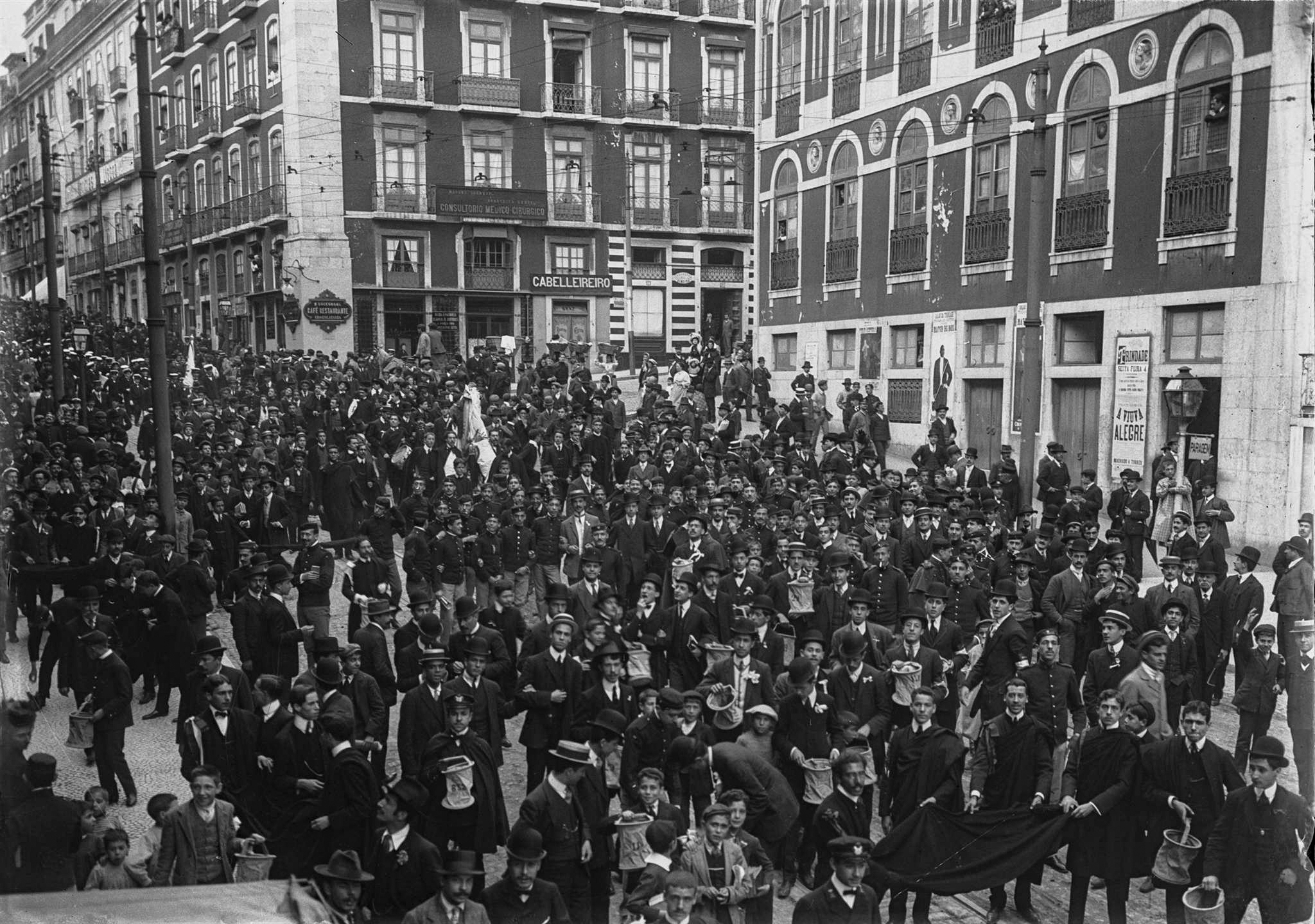
DescriptionStudents in Lisbon collecting donations for victims of the 1909 Benavente earthquake. The magnitude 6.0 earthquake devastated the Lower Tagus Valley, killing at least 60 people and heavily damaging much of Benavente and neighbouring towns.
LicenseArquivo Municipal de Lisboa, Public domain, via Wikimedia Commons